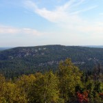
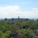
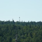
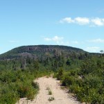
Ishpatina Ridge (North Peak)
Posted by Derek on May 25, 2010
Rank: 3
Height: 2221 feet / 677 m
GPS recorded height: 2247 feet / 685 m
Lat/Lon: N47 19.977, W80 44.014
Line Parent: Ishpatina Ridge (Tower Summit)
Key Col: N47 19.742 W80 44.593 (1640 ft / 500 m)
Clean Prominence: 581ft / 177m
Date Summited: May 1st, 2010
Overview:
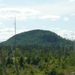
The Ishpatina Ridge traverses several rounded humps and under the Ontario 2100 Footer criteria, 3 of these qualify as being distinct 2100+ foot peaks. The familiar Fire Tower summit of the Ishpatina Ridge is the highest point in Ontario and a popular destination. It is reachable via a trail from Scarecrow Lake. The North Peak as seen from the Fire Tower summit appears to be just as high if not higher, but according to Ontario’s Ministry of Natural Resources Ontario Base Maps (OBM) series, it is 43 feet lower. There is no trail to the North Peak of the Ishpatina Ridge and several approaches are hindered by cliffs surrounding the peak.
Ishpatina Ridge (South Peak)
Posted by Derek on Jan 12, 2010
Rank: 5Height: 2188 feet / 667 m
GPS recorded height: 2198 feet / 670 m
Lat/Lon: N47 18.389 W80 45.906
Line Parent: Ishpatina Ridge (Tower Summit)
Key Col: N47 18.704 W80 45.312 (1952ft / 595m)
Clean Prominence: 236ft / 72m
Date Summited: August 1, 2010
Overview:
The Ishpatina Ridge traverses several rounded bumps and under the Ontario 2100 Footer criteria, 3 of these qualify as being distinct 2100+ foot peaks. The highest point, the familiar Tower summit of the Ishpatina Ridge is the highest point in Ontario and a popular hiking and canoeing destination. The South Peak, the lowest of the 3 peaks, ranks as Ontario’s 5th highest point. Despite being only a short bushwhack from the trail leading from Scarecrow Lake to the Ishpatina Ridge Tower summit, the South Peak remains relatively unexplored. A small lake at the summit is crowned by several candidate high points. OBM map spot elevations indicate that the southwestern-most point is the highest.
Directions:
Due to it’s close proximity to the Ishpatina Ridge Trail, the best approach to the South Peak is to hike to it in conjunction with a trip to the main Tower Peak via an overland trip or canoe trip. Although it’s shorter to bushwhack directly to the primary candidate high point from the height of land just south of Dick Lake, the route is made difficult by the extremely thick underbrush which dominates the south slopes of the peak. Instead, it is recommended to bushwhack to the secondary candidate high point first, then bushwhack west around the small lake atop the South Peak to the primary high point, and return back to Dick Lake by retracing the route in.
From the trailhead on Scarecrow Lake, follow the Ishpatina Ridge Trail to Dick Lake. Turn left and follow the lake shoreline west for 250 meters until reaching a small stream at the western edge of the lake. From here bushwhack west and paralleling the stream for about 500 meters to a small lake / wetland. Head northwest around the edge of the lake / wetland area and ascend the hill up to the secondary candidate high point at N47.3088, W80.7612. To get to the primary high point from here, continue the counter-clockwise swing around the lake / wetland by heading west for 250 meters, then south for 500 meters to an open area composed of ferns and moss covered rock outcrops. The height of land at N47.3065, W80.7651 is the likely candidate for the highest point on the South Peak.
Read the rest of this entry »
Carson Creek Peak
Posted by Derek on Sep 3, 2009
Rank: 4
Height: 2198 feet / 670 m
GPS recorded height: 2217 feet / 675 m
Lat/Lon: N48 21.283 W90 00.793
Line Parent: Tower Mountain
Key Col: N48 20.675 W90 01.146 (1969ft / 600m)
Clean Prominence: 229ft / 70m
Date Summited: August 20, 2009
Overview:
Carson Creek Peak is the name given by Brian Back of OtterTooth.com to the fourth highest summit in Ontario. The peak is the second highest point atop a ridge which runs northeast from beyond Tower Mt. and the summit is marked by the Aldina fire tower. Carson Creek Peak is the highest road accessed peak in Ontario.
Tower Mountain
Posted by Derek on Sep 2, 2009
Rank: 2
Height: 2228 feet / 679 m
GPS recorded height: 2260 feet / 689 m
Lat/Lon: N48 18.444 W90 05.667
Line Parent: Ishpatina Ridge (Tower Summit)
Key Col: N49 35.298 W85 41.667 (997ft / 299m)
Clean Prominence: 1247ft / 380m
Date Summited: August 21, 2009
Overview:
Taken from www.peakbagger.com:
Tower Mountain is the second highest peak in Ontario. The peak is part of the range of hills on the northwest shore of Lake Superior, not far from the city of Thunder Bay.
The name “Tower Mountain” is relatively new. For many years this summit was just known as a unnamed spot elevation in the “Thunder Bay Hills”. But the recent Ontario Base Map (1:20,000) published by the MNR (Ministry of Natural Resources) clearly labels the summit with its name and elevation. Ironically, the MNR seems to have forgotten that a tower was ever constructed here.
The peak is a broad, flat-topped ridge, with steep slopes and cliffs surrounding the central plateau. The summit is a very broad flat area, and it is marked by clearings with lots of debris from an old tower. You can see the tower footings, the wreckage of the wooden observation box, old cables, and electrical junk lying around. A rise to the north of the tower area may be the actual highpoint, but it’s hard to tell. There are no views, but if you bushwhack to the west for a tenth of a mile you will come to the top of the cliffs, where a nice vista of clear-cut forests extends for miles.
Head Lake Peak East
Posted by Derek on Aug 29, 2009
Head Lake Peak East
Rank: 5
Height: 2188 feet / 667 m
GPS recorded height: 2207 feet / 673 m
Lat/Lon: N48 17.780 W90 07.312
Line Parent: Tower Mountain
Key Col: N48 17.766 W90 05.883 (1772 ft / 540m)
Clean Prominence: 416ft / 127m
Date Summited: August 23, 2009
Overview:
The Head Lake Peaks are a group of peaks north of Head Lake in the hills 65 km West of Thunder Bay. Head Lake Peak East is the highest of the mountain group and shares its ridge with the lower but equally prominent South Peak. It is also only 2.5 km southwest from the highest peak in the region, Tower Mt. Head Lake Peak East is a trailless peak and the closest trail is 500 meters northwest of the summit. The mountain has impressive cliff faces on its southeastern slopes.
Prelate Lake Peak
Posted by Derek on Aug 28, 2009
Prelate Lake Peak
Rank: 8
Height: 2152 feet / 656 m
GPS recorded height: 2158 feet / 658 m
Lat/Lon: N48 10.330/W90 22.027
Line Parent: Head Lake Peak East
Key Col: N48 15.771 W90 12.396 (1608ft / 490m)
Clean Prominence: 544ft / 166m
Date Summited: August 21, 2009
Overview:
Prelate Lake Peak is a trailless peak in the hills west of Thunder Bay. It’s namesake lake is a popular lake for fishing located northwest of the summit. The peak is a short distance from route 588 and there is a trail for more than half of the distance to the summit.
Maple Mountain
Posted by Derek on Jul 18, 2009
Rank: 17
Height: 2106 feet / 642 m
GPS recorded height: 2116 feet / 645 m
Lat/Lon: N47 23.225/W80 20.097
Line Parent: Ishpatina Ridge (Tower Summit)
Key Col: N47 28.178 W80 23.024 (1211ft / 369m)
Clean Prominence: 895ft / 273m
Date Summited: July 13, 2009
Overview:
Maple Mountain is located within the Temagami region’s Lady Evelyn-Smoothwater Provincial Park. One of the best known mountains in Ontario, it’s vertical rise over the surrounding landscape: approximately 1150 feet is one of the highest in the province. Because of this, it is often mistaken as being the highest mountain in Ontario, however Maple Mountain is actually ranked seventeenth. A 100 foot intact fire tower stands on the summit and can be reached via A 3.3 km long hiking trail.
The indigenous Temagami First Nation called the mountain Chee-bay-jing, which means “the place where the spirits go” and considered it a sacred site. The mountain was named by Dr. Robert Bell of the Geological Survey of Canada in 1888. Bell was the first known non-aboriginal to scale the mountain.
Ishpatina Ridge (Tower Summit)
Posted by Derek on Jan 25, 2009
Rank: 1Height: 2275 feet / 693 m
GPS recorded height: 2292 feet / 699 m
Lat/Lon: N47 19.013, W80 44.964
Key Col: N49 32.433 W85 35.183 (981ft / 299m)
Clean Prominence: 1293ft / 394m
Date Summited: September 2, 2007
Overview:
The Ishpatina Ridge, set in a remote corner of the Lady Evelyn-Smoothwater wilderness park, is a series of worn and rounded bumps spanning approximately 13 km. The Ellis Fire Tower, a lonely sentry and reminder of days of old, sits on the tallest of the bumps and looks out across the vast expanse of Canadian Shield wilderness. At a height of 2275 feet / 693 m, the Ishpatina Ridge is the highest point in Ontario.
Ogidaki Mountain
Posted by Derek on Jan 21, 2009
Rank: 7Height: 2182 feet / 665 m
GPS recorded height: 2200 feet / 671 m
Lat/Lon: N46 59.533, W83 59.015
Line Parent: Ishpatina Ridge (Tower Summit)
Key Col: N47 27.157 W81 01.900 (1250ft / 381m)
Clean Prominence: 932ft / 284m
Date Summited: July 22, 2008
Overview:
Ogidaki Mountain, a high hill in the Algoma Highlands north of Sault Ste. Marie, was once thought to be the highest point in Ontario. With the release of the 1:50,000 series topographical maps in 1970, the Ishpatina Ridge took top honour as the highest peak. Ogidaki now sits at #7, and depending on who you ask is 2182 feet high. Today, although a series of active and overgrown logging roads lead to the summit, it is seldom visited. A fire tower once stood at the summit.
Edit: Ontario’s Ministry of Natural Resources removed the fire tower in May of 2016.
Griffin Lake Peak
Posted by Derek on Jan 16, 2009
Rank: 8Height: 2152 feet / 656 m
GPS recorded height: 2135 feet / 651 m
Lat/Lon: N47 04.535, W84 22.949
Line Parent: Ogidaki Mt
Key Col: N47 08.286 W84 18.010 (1345ft / 410m)
Clean Prominence: 807ft / 246m
Date Summited: July 21, 2008
Updated: November 7, 2015
Overview:
Griffin Lake Peak is the name given by Brian Back of Ottertooth.com to an unnamed peak in the Algoma Region, north of Sault Ste. Marie. Dirt roads of varying condition lead to the broad summit which is marked by a well preserved fire tower. The open summit rewards the hiker with 360 degree views.
There is some confusion over the identity of Batchawana Mountain and whether Griffin Lake Peak is in fact Batchawana Mountain. The 2 mountains with their close proximity share the same massif and could be considered 2 peaks on the same mountain. However, Ministry of Natural Resources maps clearly mark the lower summit (below 2100 feet) southwest of Griffin Lake Peak as Batchawana Mountain, even though there are sources that indicate that Batchawana Mountain is one of the highest points in the province. The peak identified here as Griffin Lake Peak (not an official name) is clearly the higher peak, and exceeds 2100 feet.
