Gong Lake Peak
Posted by Derek on Sep 24, 2011
Rank: 18
Height: 2106 feet / 642 m
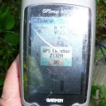
GPS recorded height: 2132 feet / 650 meters
Lat/Lon: N47.04822 W83.62115
Line Parent: Witchdoctor Lake Peak
Key Col: N47 03.397 W83 42.148 (1624ft / 495m)
Clean Prominence: 482ft / 147m
Date Summited: August 15, 2011
Overview:
North of Ranger Lake in a remote corner of the Algoma highlands, Gong Lake Peak is one of three virtually unknown high points. It is thus named because of its close proximity to the lake bearing its name. There are no trails to the summit, however it can be hiked in a day by bushwhacking from one of the nearby logging roads in the area.
Directions:
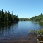
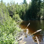
Click here for directions from Sudbury to nearby Gravel Lake. From Gravel Lake, follow Domtar Road northeast for 5.5 km until reaching the junction with an ATV trail at N47.04537 W83.58467. Follow the ATV trail northwest for 800 meters at which time a second ATV trail enters from the right. Stay to the left at the fork and follow the trail for another 700 meters until it ends at a beaver dam at the east end of a lake. Cross the beaver dam and begin the bushwhack along the north edge of the lake. The bushwhacking will be difficult as a there is a steep hill running down into the lake and the bush on the hill is equally thick as along the flooded shoreline.
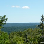
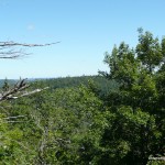
After bushwhacking 700 meters and reaching the northwest end of the lake, you must pass around a flooded lowland forest and cross a small creek. Beyond the creek crossing, the bushwhacking eases into more open forest and begins to ascend the remaining 1.1 km to the summit. A few rocky humps adorn the hardwood forested summit – the one at the northeastern edge of the highest contour is the highest point on the peak. The high point is treed, however there are good views to the north and east from a rocky ledge 30 meters to the east.
View a larger version of the map
Trip Summary:
0.0 km – Parking on ATV Road / Domtar Road 5.5 km northeast of Gravel Lake
0.8 km – Turn left at the fork
1.5 km – ATV trail ends at beaver dam. Start of bushwhack.
2.2 km – Creek crossing
3.7 km – Gong Lake Peak summit
Trip Report:
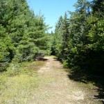
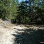
We pulled off Domtar Road, parked alongside the ATV trail and began the hike in. In some sections there were quite a few fallen trees across the trail, which we had to step over – but it was still easier than bushwhacking. After hiking 800 meters, another trail intersected our trail to the right. We stayed to the left at the fork and headed west towards the unnamed lake situated at the base of the eastern slopes of Gong Lake Peak.
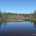
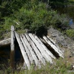
1.5 km from the parked truck, we arrived at the east edge of the lake. The trail appeared to cross a beaver dam, so we followed it across. After crossing the dam, the trail evaporated and we couldn’t find any sign of it. We accepted that we would have to begin the bushwhack earlier than expected and commenced bushwhacking along the north shore of the lake. The underbrush was thick and it was quite difficult to push ourselves through. As well, the terrain was challenge as the tradeoff to avoid the flooded lakeshore was to bushwhack along the steep hillside. We made slow and steady process towards the west side of the lake, however Terry who was dealing with an injured knee from our Seal Lake Peak hike decided to avoid further injury and turned back. Since I was only 1 km from the summit, I resolved to continue onto the summit and meet Terry back at the truck.
After passing through a flooded lowland forest and crossing a small stream feeding the lake, I reached the eastern slopes of Gong Lake Peak and began the ascent. The dense bush gave way to more open forest and I was able to process more easily.
After passing around a few rock faces on the ascent, I arrived at the hardwood forested summit area of the peak. After exploring the area and traversing a couple of ‘false’ summits, I finally made my way to the coordinates of the highest point on Gong Lake Peak. I took photos and created waypoints at the high point, however as there were no views at the treed summit, I continued on and hiked east to where I had spotted a rocky clearing on my ascent.
Once I climbed up onto the rocky ledge, the trees gave way to good views east, the best views all trip. It was a nice day, so I enjoyed a small lunch, gazing at the distant hills. As I didn’t want to keep Terry waiting at the truck for long, I made haste on my descent. I followed the same route back down, arriving back at the truck 1 hour 40 minutes later.
Gong Lake Peak GPS Track (.gpx format)
Related Links:
Gong Lake Peak on peakbagger.com
