Scrabble Mountain
Posted by Derek on May 13, 2009
Rank: NA (below 2100 feet)
Height: 1131 feet / 345 m
Lat/Lon: N44 49.771 W78 51.341
Date Summited: May 6, 2009
Overview:
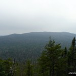
Scrabble Mountain is a broad hill in the Queen Elizabeth II Wildlands Provincial Park. Accessible via the Ganaraska Trail, the peak is 8.5 km (by trail) northwest of Moore Falls and 15 km south of Minden, Ontario. The peak has limited but scenic views of the surrounding terrain and it’s noteworthy for the exposed granite rock ridges especially on the southern approach. The hill’s close proximity to the major population centers of Southern Ontario make this an ideal day hike from the city. The summit is marked with a memorial to Aldie LeCraw.
Ishpatina Ridge (Tower Summit)
Posted by Derek on Jan 25, 2009
Rank: 1Height: 2275 feet / 693 m
GPS recorded height: 2292 feet / 699 m
Lat/Lon: N47 19.013, W80 44.964
Key Col: N49 32.433 W85 35.183 (981ft / 299m)
Clean Prominence: 1293ft / 394m
Date Summited: September 2, 2007
Overview:
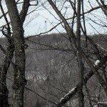
The Ishpatina Ridge, set in a remote corner of the Lady Evelyn-Smoothwater wilderness park, is a series of worn and rounded bumps spanning approximately 13 km. The Ellis Fire Tower, a lonely sentry and reminder of days of old, sits on the tallest of the bumps and looks out across the vast expanse of Canadian Shield wilderness. At a height of 2275 feet / 693 m, the Ishpatina Ridge is the highest point in Ontario.
Silver Peak
Posted by Derek on Jan 23, 2009
Rank: NA (below 2100 feet)
Height: 1768 feet / 539 m
Lat/Lon: N46 06.662 W81 17.357
Date Summited: June 25, 2005
Overview:
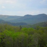
Located in Killarney Provincial Park, Silver Peak is the pinnacle of the La Cloche Mountains, a weathered 3.5 billion year old mountain range that was once higher than today’s Rocky Mountains. The peak is so named because of the silvery gleam the white quartzite gives off in the sunshine. Although not the highest elevation in Ontario, the peak is well regarded for it’s mountainous terrain and sweeping views, and as such is a popular hiking destination.
Directions:
There are several routes to Silver Peak, the most common ones being:
- An overland route via the 7-8 day 80 km La Cloche Silhouette Trail, which circumnavigates Killarney Provincial Park
- A 5.7 km hike to the summit combined with a 3.3 km canoe paddle in from Bell Lake (easily accomplished in a day)
- A 3.5 km bushwhack from the Bell Lake Parking area to the Silver Peak Trail and completing the remaining 5.7 km to the summit on this trail
Below details the route to Silver Peak via Bell Lake:
From Toronto, take Highway 400/69 north past Barrie and Parry Sound. 29 km past the French River turn left (West) on 637. At kilometer 36 on 637, there will be a gravel road turn off at the right (North) to the Bell Lake Access point. Depending on the time of year, parking permits may not be available at Bell Lake and will need to be bought at the George Lake Park Office, which is 20 km further along on 637. There may be a sign at the turn off indicating the status of the Bell Lake permit office. Camping/backcountry passes are not needed if this is a day trip outing. It’s a 9 km drive from 637 to the parking area at Bell Lake. Canoe rentals can be arranged at Bell Lake.
Ogidaki Mountain
Posted by Derek on Jan 21, 2009
Rank: 7Height: 2182 feet / 665 m
GPS recorded height: 2200 feet / 671 m
Lat/Lon: N46 59.533, W83 59.015
Line Parent: Ishpatina Ridge (Tower Summit)
Key Col: N47 27.157 W81 01.900 (1250ft / 381m)
Clean Prominence: 932ft / 284m
Date Summited: July 22, 2008
Overview:
Ogidaki Mountain, a high hill in the Algoma Highlands north of Sault Ste. Marie, was once thought to be the highest point in Ontario. With the release of the 1:50,000 series topographical maps in 1970, the Ishpatina Ridge took top honour as the highest peak. Ogidaki now sits at #7, and depending on who you ask is 2182 feet high. Today, although a series of active and overgrown logging roads lead to the summit, it is seldom visited. A fire tower once stood at the summit.
Edit: Ontario’s Ministry of Natural Resources removed the fire tower in May of 2016.
Griffin Lake Peak
Posted by Derek on Jan 16, 2009
Rank: 8Height: 2152 feet / 656 m
GPS recorded height: 2135 feet / 651 m
Lat/Lon: N47 04.535, W84 22.949
Line Parent: Ogidaki Mt
Key Col: N47 08.286 W84 18.010 (1345ft / 410m)
Clean Prominence: 807ft / 246m
Date Summited: July 21, 2008
Updated: November 7, 2015
Overview:
Griffin Lake Peak is the name given by Brian Back of Ottertooth.com to an unnamed peak in the Algoma Region, north of Sault Ste. Marie. Dirt roads of varying condition lead to the broad summit which is marked by a well preserved fire tower. The open summit rewards the hiker with 360 degree views.
There is some confusion over the identity of Batchawana Mountain and whether Griffin Lake Peak is in fact Batchawana Mountain. The 2 mountains with their close proximity share the same massif and could be considered 2 peaks on the same mountain. However, Ministry of Natural Resources maps clearly mark the lower summit (below 2100 feet) southwest of Griffin Lake Peak as Batchawana Mountain, even though there are sources that indicate that Batchawana Mountain is one of the highest points in the province. The peak identified here as Griffin Lake Peak (not an official name) is clearly the higher peak, and exceeds 2100 feet.


