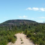
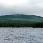
Ishpatina Ridge (North Peak) – Overland
Posted by Derek on Sep 23, 2019
Rank: 3
Height: 2221 feet / 677 m
GPS recorded height: 2247 feet / 685 m
Lat/Lon: N47 19.977, W80 44.014
Line Parent: Ishpatina Ridge (Tower Summit)
Key Col: N47 19.742 W80 44.593 (1640 ft / 500 m)
Clean Prominence: 581ft / 177m
Date Summited: August 9th, 2019
Overview:
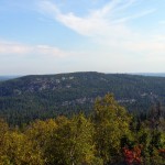
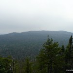
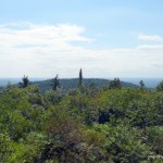
The Ishpatina Ridge traverses several rounded humps and under the Ontario 2100 Footer criteria, 3 of these qualify as being distinct 2100+ foot peaks. The familiar Fire Tower summit of the Ishpatina Ridge is the highest point in Ontario and a popular destination. It is reachable via a trail from Scarecrow Lake. The North Peak as seen from the Fire Tower summit appears to be just as high, but according to Ontario’s Ministry of Natural Resources Ontario Base Maps (OBM) series, it is 43 feet lower. There is no trail to the North Peak of the Ishpatina Ridge and the route from Ishpatina – Tower Peak is hindered by the steep cliffs surrounding the peak.
Ishpatina Ridge (Tower Summit) – Overland
Posted by Derek on Sep 5, 2010
Rank: 1
Height: 2275 feet / 693 m
GPS recorded height: 2298 feet / 700 m
Lat/Lon: N47 19.002, W80 44.930
Key Col: N49 32.433 W85 35.183 (981ft / 299m)
Clean Prominence: 1293ft / 394m
Summited on (Overland Route): August 1, 2010
Overview:
The Ishpatina Ridge, set in a remote corner of the Lady Evelyn-Smoothwater wilderness park, is a series of worn and rounded bumps spanning approximately 13 km. The Ellis Fire Tower, a lonely sentry and reminder of days of old, sits on the tallest of the bumps and looks out across the vast expanse of Canadian Shield wilderness. At a height of 2275 feet / 693 m, the Ishpatina Ridge is the highest point in Ontario. From a logging road crossing at the Sturgeon River, the Ishpatina Ridge can be climbed in a day by following a series of logging roads, overgrown bush roads, hiking trails and bushwhacks.
Directions:
There are 2 routes to the Ishpatina Ridge:
- The traditional and most common route begins as a multi-day canoe trip up the Montreal River, over a series of lakes and portages between Smoothwater Lake and Scarecrow Lake and ends with a hike up to the summit via an old fire tower watchman’s trail.
- More recently, many hikers have begun to use an overland route accessed via a series of logging roads which are accessed north of Capreol (near Sudbury). Most hikers begin on foot or by bike at a rugged road crossing of the Sturgeon River and follow the road north to a series of overgrown bush trails. Combined with a bushwhack along the west shore of Scarecrow Lake and the usual fire tower trail hike from the trailhead on Scarecrow Lake, many hikers are able to complete the trip from car to car in a long day hike.
Click here for my trip report to Ishpatina Ridge via the Montreal River (traditional canoe route)
Directions to the Ishpatina Ridge via the overland route is as follows:
From the Sudbury area, make your way to Garson either via the Falconbridge Highway (RR-86) or the Garson/Coniston Road (RR-90). Take RR-85 for 18.4 km to Hanmer, and after it jogs across the train tracks follow RR-84 to Capreol which is 6.5 km ahead. Passing through the small town of Capreol, continue along the road for another 8.0 km and then turn right onto Portelance Road. It is 64.4 km from the intersection at Portelance Road to the Sturgeon River, so it would be advisable to make sure you have proper provisions before making the trip. Also, the road may have active logging in progress, so caution is advised — give the logging trucks a lot of space.
The first 5 km of the dirt road is fairly wide and well traveled by the residents of the Wahnapitae First Nation Reserve. The road forks at the Wahnapitae First Nation Reserve sign. Take the left fork and proceed along the road which runs in a north-northeast direction for 15.5 km until meeting up with the Wanapitei River. Do not cross the River at the bridge here, but continue along the west shoreline of the River for another 5.3 km. 20.8 km from the turnoff at the Wahnapitae Reserve, the road crosses the Wanapitei River and follows the eastern shore of the river for another 8.8 km until Stobie Road forks to the right. Cars with low ground clearance will have to be cautious as sometimes the gravel can pile up in the center of the road. Turn right (east) onto Stobie Road and follow the road eastward.
After 5.7 km, the Gervais Road which travels 24 km to the south shore of the Sturgeon River, branches to the left. Following the Gervais Road north, turn left at the forks at 9.2 km and 14.1 km from the intersection with Stobie Road. The final 15 km of road, although quite rough, are still passable for cars as long as caution and common sense are used — drivers should be prepared to drive 20-30 km/h. The Google satellite imagery for the northern half of the Gervais Road is not up to date (as of September 23, 2011) — please see the attached satellite imagery from geobase.ca to see the new extension to Gervais Road.Just before reaching the Sturgeon River, there is a large flat area (old gravel pit) which can easily handle group camping. There is also a smaller campsite right at the river. If camping within 120 meters of the Sturgeon River, a back country pass will be required.
In most situations it should be possible to wade across the Sturgeon River, however strong currents in combination with high water levels can make the crossing hazardous. After crossing the Sturgeon River, stay on the main gravel road north. This road can easily be biked, and if attempting to hike the Ishpatina Ridge and back in a single day, it is recommended to bring a mountain bike for this section.
5.1 km from the Sturgeon, the road fords a small stream which connects Little Scarecrow Lake and Hamlow Lake. However, there is a small makeshift log bridge just east of the road, which crosses the stream. The road skirts the eastern shore of Stull Lake and 1.4 km from the makeshift bridge, an overgrown bush road branches to the right. If on a bike, stash the bike near the intersection here and follow the overgrown bush trail on foot.
Follow the bush path north for about 290 meters and turn east on another bush path which branches to the right. Follow this path eastwards for 570 meters until reaching another fork — take the left fork. The trail past the fork, although marked with flagging tape and blazes, quickly becomes overgrown and passes through some marshy areas. Initially the overgrown trail travels east, but after 0.5 km, the trail turns north. After another 0.5 km, the trail swings right (east) and continues for 0.5 km until terminating. The remaining distance to the Ishpatina trail trailhead on Scarecrow Lake must be bushwhacked. The Ishpatina Ridge Trail trailhead lies 2.5 km (as the crow flies) away from this point. From the end of the bush trail, bushwhack 85 degrees (magnetic north) for 900 meters to the shore of Scarecrow Lake — stay along the southern edge of the hills along the route, as there is no need to climb them. Note: As of September, 2010, the trail has been extended for 1 km to Scarecrow Lake and along the west shore of the lake, cutting the bushwhack to 1.5 km.
If water levels are low on Scarecrow Lake, it may be possible to save time and energy by walking along the rocky shoreline. Occasionally, one will have to swing back into the bush to avoid blow-down and/or marshy areas. There is also a a fairly well established animal path along the lake edge. Once reaching the northwest shore of Scarecrow lake, the bushwhack ends at a well-established campsite and the start trail to the Ishpatina.
The 3.7 km trail to the Ishpatina Ridge – Tower Peak begins at the canoe launch on Scarecrow Lake and ascends through an area regenerating from a recent bush fire — wild raspberries and blueberries are abundant here. The trail skirts a small lake and begins a moderate ascent northwards. About 1.7 km from Scarecrow Lake, the trail passes through a lowland marsh near a second lake along the trail. Logs and wood planks have been layed along the trail to make the passage across easier. Once traversing the marsh, the trail begins to climb more steeply for 0.7 km.
2.4 km from Scarecrow Lake, the trail gains the top of a ridge. This would be the most advantageous place to start the bushwhack to Ishpatina’s South Peak. The trail then descends slightly to Dick Lake, the third and final lake on the route to the summit.
Crossing an overgrown beaver dam at the east edge of Dick Lake, the remaining 1.1 km of trail ascends almost 500 feet to the summit. Closer to the top, the firetower at the summit will come into view. A large boulder hidden by thick bushes at N47.31670 W80.74884, 50 meters from the base of the tower may be the highest point on the summit. At the base of the tower, there are good views towards the North and South peaks.
*Last update: September 23, 2011.
Trip Summary:
00.0 km – Turn onto Portelance Road from RR-84
05.0 km – Turn left at the fork at the Wahnapitae First Nation Reserve sign
20.7 km – Road reaches Wanapitei River, stay on the west shore of the river
25.8 km – Road crosses the Wanapitei River at Fraleck Bridge. Road continues along east shoreline
34.6 km – Turn right onto Stobie Road
40.3 km – Turn left onto Gervais Road
49.5 km – Turn left at the fork
54.4 km – Turn left at the fork
64.4 km – Gravel pit camp near Sturgeon River
00.0 km – Ford Sturgeon River and hike/bike along gravel road
06.7 km – Turn onto overgrown bush road
07.0 km – Turn right onto bush road #2
07.5 km – Take left fork onto overgrown trail
09.0 km – End of the trail, beginning of the bushwhack to Scarecrow Lake
10.1 km – Scarecrow Lake – hike along shoreline to Ishpatina Trailhead
12.3 km – End of bushwhack, beginning of the Ishpatina trail
15.0 km – Ishpatina Ridge – Tower Peak
Ishpatina Ridge (North Peak)
Posted by Derek on May 25, 2010
Rank: 3
Height: 2221 feet / 677 m
GPS recorded height: 2247 feet / 685 m
Lat/Lon: N47 19.977, W80 44.014
Line Parent: Ishpatina Ridge (Tower Summit)
Key Col: N47 19.742 W80 44.593 (1640 ft / 500 m)
Clean Prominence: 581ft / 177m
Date Summited: May 1st, 2010
Overview:
The Ishpatina Ridge traverses several rounded humps and under the Ontario 2100 Footer criteria, 3 of these qualify as being distinct 2100+ foot peaks. The familiar Fire Tower summit of the Ishpatina Ridge is the highest point in Ontario and a popular destination. It is reachable via a trail from Scarecrow Lake. The North Peak as seen from the Fire Tower summit appears to be just as high if not higher, but according to Ontario’s Ministry of Natural Resources Ontario Base Maps (OBM) series, it is 43 feet lower. There is no trail to the North Peak of the Ishpatina Ridge and several approaches are hindered by cliffs surrounding the peak.
Ishpatina Ridge (South Peak)
Posted by Derek on Jan 12, 2010
Rank: 5Height: 2188 feet / 667 m
GPS recorded height: 2198 feet / 670 m
Lat/Lon: N47 18.389 W80 45.906
Line Parent: Ishpatina Ridge (Tower Summit)
Key Col: N47 18.704 W80 45.312 (1952ft / 595m)
Clean Prominence: 236ft / 72m
Date Summited: August 1, 2010
Overview:
The Ishpatina Ridge traverses several rounded bumps and under the Ontario 2100 Footer criteria, 3 of these qualify as being distinct 2100+ foot peaks. The highest point, the familiar Tower summit of the Ishpatina Ridge is the highest point in Ontario and a popular hiking and canoeing destination. The South Peak, the lowest of the 3 peaks, ranks as Ontario’s 5th highest point. Despite being only a short bushwhack from the trail leading from Scarecrow Lake to the Ishpatina Ridge Tower summit, the South Peak remains relatively unexplored. A small lake at the summit is crowned by several candidate high points. OBM map spot elevations indicate that the southwestern-most point is the highest.
Directions:
Due to it’s close proximity to the Ishpatina Ridge Trail, the best approach to the South Peak is to hike to it in conjunction with a trip to the main Tower Peak via an overland trip or canoe trip. Although it’s shorter to bushwhack directly to the primary candidate high point from the height of land just south of Dick Lake, the route is made difficult by the extremely thick underbrush which dominates the south slopes of the peak. Instead, it is recommended to bushwhack to the secondary candidate high point first, then bushwhack west around the small lake atop the South Peak to the primary high point, and return back to Dick Lake by retracing the route in.
From the trailhead on Scarecrow Lake, follow the Ishpatina Ridge Trail to Dick Lake. Turn left and follow the lake shoreline west for 250 meters until reaching a small stream at the western edge of the lake. From here bushwhack west and paralleling the stream for about 500 meters to a small lake / wetland. Head northwest around the edge of the lake / wetland area and ascend the hill up to the secondary candidate high point at N47.3088, W80.7612. To get to the primary high point from here, continue the counter-clockwise swing around the lake / wetland by heading west for 250 meters, then south for 500 meters to an open area composed of ferns and moss covered rock outcrops. The height of land at N47.3065, W80.7651 is the likely candidate for the highest point on the South Peak.
Read the rest of this entry »
Ishpatina Ridge (Tower Summit)
Posted by Derek on Jan 25, 2009
Rank: 1Height: 2275 feet / 693 m
GPS recorded height: 2292 feet / 699 m
Lat/Lon: N47 19.013, W80 44.964
Key Col: N49 32.433 W85 35.183 (981ft / 299m)
Clean Prominence: 1293ft / 394m
Date Summited: September 2, 2007
Overview:
The Ishpatina Ridge, set in a remote corner of the Lady Evelyn-Smoothwater wilderness park, is a series of worn and rounded bumps spanning approximately 13 km. The Ellis Fire Tower, a lonely sentry and reminder of days of old, sits on the tallest of the bumps and looks out across the vast expanse of Canadian Shield wilderness. At a height of 2275 feet / 693 m, the Ishpatina Ridge is the highest point in Ontario.
Ghost Range Peak
Posted by Derek on Aug 10, 2017
Height: 1601 feet / 488 meters
GPS recorded height: 1607 feet / 490 meters
Lat/Lon: N48 32.326 W79 50.106
Date Summited: July 31, 2017
Overview:
Ghost Range Peak is a 2.7 billion year old layered intrusion / sill located south of Lake Abitibi. It is the highest point in Ontario’s Cochrane District. It’s a short hike to the summit along trails that depart from a sand quarry located near the corner of Hwy 101 and Hwy 672. The fire tower that once stood at the summit was recently removed by Ontario’s Ministry of Natural Resources.
Tower Mountain – Revisited
Posted by Derek on Jan 8, 2017
Rank: 2Height: 2228 feet / 679 m
GPS recorded height: 2260 feet / 689 m
Lat/Lon: N48 18.448 W90 05.674
Line Parent: Ishpatina Ridge (Tower Summit)
Key Col: N49 35.298 W85 41.667 (997ft / 299m)
Clean Prominence: 1247ft / 380m
Date Summited: July 28, 2016
Overview:
Tower Mountain is the second highest peak in Ontario. The peak is part of the range of hills on the northwest shore of Lake Superior, 45 kilometers west from Thunder Bay.
The name “Tower Mountain” is relatively new. For many years this summit was just known as a unnamed spot elevation in the “Thunder Bay Hills”. But the recent Ontario Base Map (1:20,000) published by the MNR (Ministry of Natural Resources) clearly labels the summit with its name and elevation. Ironically, the MNR seems to have forgotten that a tower was ever constructed here.
The peak is a flat-topped ridge, with steep slopes and cliffs surrounding the central plateau. The summit is a very broad flat area with lots of clearings and debris from an old tower. You can see the tower footings, the wreckage of the wooden observation box, old cables, and electrical junk lying around. There are no views at the summit, but if you make your way west for 150 meters you will come to the top of the cliffs where you’ll be able to get a nice vista of the surrounding area.
County High Points
Posted by Derek on Oct 26, 2009
Listed below are the county high points of Ontario:
(Source: peakbagger.com)
| Rank | County | Name | Height | Lat | Lon |
|---|---|---|---|---|---|
| 1 | Sudbury District | Ishpatina Ridge | 2274 | N47.3169 | W80.7494 |
| 2 | Thunder Bay | Tower Mountain | 2228 | N48.3074 | W90.0945 |
| 3 | Timiskaming | Ishpatina Ridge North | 2221 | N47.333 | W80.7336 |
| 4 | Algoma | Ogidaki Mountain | 2182 | N46.9922 | W83.9839 |
| 5 | Nipissing | Southern Ontario High Point | 1896 | N45.6489 | W78.2573 |
| 6 | Haliburton | Manitou Mountain | 1847 | N45.44460 | W78.58269 |
| 7 | Kenora | Kenora District High Point | 1834 | N49.1159 | W91.2876 |
| 8 | Grey | Grey County High Point | 1785 | N44.3182 | W80.3198 |
| 8 | Simcoe | Niagara Escarpment High Point | 1785 | N44.3715 | W80.249 |
| 8 | Rainy River | Rainy River District High Point | 1785 | N48.167 | W91.2572 |
| 11 | Dufferin | Dufferin County High Point | 1778 | N44.2066 | W80.2808 |
| 11 | Hastings | Hastings County High Point | 1778 | N45.24067 | W78.12825 |
| 11 | Muskoka | Muskoka High Point | 1778 | N45.5074 | W78.9347 |
| 14 | Parry Sound | Parry Sound High Point | 1745 | N45.81471 | W79.16865 |
| 15 | Renfrew | Ryan’s Mountain | 1716 | N45.43028 | W77.30493 |
| 16 | Wellington | Luther Benchmark | 1677 | N43.8970 | W80.4322 |
| 17 | Sudbury City | Wolf Lake Mountain | 1654 | N46.8626 | W80.6611 |
| 18 | Lennox and Addington | Moger Pond Peak | 1644 | N45.16132 | W77.30609 |
| 19 | Peel | Peel High Point | 1621 | N43.9285 | W80.0318 |
| 20 | Cochrane | Ghost Range Peak | 1601 | N48.5388 | W79.8352 |
| 21 | Waterloo | Waterloo High Point | 1437 | N43.5291 | W80.7228 |
| 22 | Peterborough | Peterborough County High Point | 1424 | N44.8543 | W78.1854 |
| 23 | Perth | Perth County High Point | 1401 | N43.3995 | W80.8301 |
| 24 | Frontenac | Evergreen Mountain | 1368 | N45.1384 | W76.9166 |
| 25 | Halton | Halton High Point | 1358 | N43.6564 | W80.0545 |
| 26 | Durham | Durham High Point | 1345 | N44.0313 | W79.0751 |
| 27 | Bruce | Bruce County High Point | 1322 | N43.9827 | W81.0694 |
| 28 | Huron | Huron County High Point | 1302 | N43.9127 | W80.9987 |
| 28 | Kawartha Lakes | Kawartha Lakes High Point | 1302 | N44.1323 | W78.6416 |
| 30 | Oxford | Oxford County High Point | 1283 | N43.2042 | W81.0179 |
| 31 | Lanark | White Mountain | 1266 | N45.1810 | W76.6381 |
| 32 | York | York High Point | 1243 | N44.0287 | W79.2447 |
| 33 | Northumberland | Northumberland County High Point | 1168 | N44.1107 | W78.0741 |
| 34 | Manitoulin | Cup and Saucer | 1155 | N45.8500 | W82.1061 |
| 35 | Middlesex | Middlesex County High Point | 1122 | N43.1424 | W81.1089 |
| 36 | Brant | Brant County High Point | 1073 | N43.2677 | W80.4354 |
| 37 | Hamilton | Hamilton High Point | 1063 | N43.4535 | W80.0178 |
| 38 | Elgin | Elgin County High Point | 971 | N42.8909 | W80.9192 |
| 39 | Norfolk | Norfolk County High Point | 912 | N42.9681 | W80.5175 |
| 40 | Brantford | Brantford High Point | 876 | N43.1727 | W80.3484 |
| 41 | Lambton | Lambton County High Point | 866 | N43.0073 | W81.8087 |
| 42 | Niagara | Niagara High Point | 850 | N43.0516 | W79.3052 |
| 43 | Chatham-Kent | Chatham-Kent High Point | 764 | N42.4542 | W81.7685 |
| 43 | Essex | Essex County High Point | 764 | N42.0662 | W82.6599 |
| 45 | Haldimand | Haldimand County High Point | 758 | N42.9749 | W79.9563 |
| 46 | Leeds and Grenville | Leeds and Grenville High Point | 696 | N44.7798 | W76.4231 |
| 46 | Toronto | Toronto High Point | 696 | N43.7796 | W79.4922 |
| 48 | Ottawa | Ottawa High Point | 545 | N45.2347 | W76.0508 |
| 49 | Prince Edward | East Picton Bay Hill | 509 | N44.0318 | W77.1125 |
| 50 | Stormont, Dundas and Glengarry | Stormont-Dundas-Glengarry High Point | 410 | N45.236 | W74.8755 |
| 51 | Prescott and Russell | Vankleek Hill | 404 | N45.5157 | W74.6567 |
 = Ascended
View a larger version of the map
The Ontario County High Points List was created by Greg Slayden of Peakbagger.com. Ontario is administratively divided into 51 units that are a mixture of counties, unified counties, regional municipalities, districts, cities, and municipalities. Elevation measurements were taken from the 1:20,000-scale Ontario Base Maps (OBM) series produced by Ontario’s Ministry of Natural Resources. These maps feature a 10-metre contour interval and an extensive set of spot heights for which the ministry reports a vertical accuracy of 2.5 metres. Contour interval accuracy is 5 metres. All the spot elevations in the OBM data were downloaded, matched to their county by a point-in-polygon operation, and the highest spot elevations picked out. When encountering multiple spot elevations of the same height in the same general location, one representative point was picked. Also, some OBM spot elevations were clearly erroneous outliers and had to be discarded. In general, a 1-meter difference in spot elevations was considered significant, and these lower points were not considered high-point candidates.
Related Links
Ontario County High Points / Peakbagger.com
Tower Mountain
Posted by Derek on Sep 2, 2009
Rank: 2
Height: 2228 feet / 679 m
GPS recorded height: 2260 feet / 689 m
Lat/Lon: N48 18.444 W90 05.667
Line Parent: Ishpatina Ridge (Tower Summit)
Key Col: N49 35.298 W85 41.667 (997ft / 299m)
Clean Prominence: 1247ft / 380m
Date Summited: August 21, 2009
Overview:
Taken from www.peakbagger.com:
Tower Mountain is the second highest peak in Ontario. The peak is part of the range of hills on the northwest shore of Lake Superior, not far from the city of Thunder Bay.
The name “Tower Mountain” is relatively new. For many years this summit was just known as a unnamed spot elevation in the “Thunder Bay Hills”. But the recent Ontario Base Map (1:20,000) published by the MNR (Ministry of Natural Resources) clearly labels the summit with its name and elevation. Ironically, the MNR seems to have forgotten that a tower was ever constructed here.
The peak is a broad, flat-topped ridge, with steep slopes and cliffs surrounding the central plateau. The summit is a very broad flat area, and it is marked by clearings with lots of debris from an old tower. You can see the tower footings, the wreckage of the wooden observation box, old cables, and electrical junk lying around. A rise to the north of the tower area may be the actual highpoint, but it’s hard to tell. There are no views, but if you bushwhack to the west for a tenth of a mile you will come to the top of the cliffs, where a nice vista of clear-cut forests extends for miles.
Maple Mountain
Posted by Derek on Jul 18, 2009
Rank: 17
Height: 2106 feet / 642 m
GPS recorded height: 2116 feet / 645 m
Lat/Lon: N47 23.225/W80 20.097
Line Parent: Ishpatina Ridge (Tower Summit)
Key Col: N47 28.178 W80 23.024 (1211ft / 369m)
Clean Prominence: 895ft / 273m
Date Summited: July 13, 2009
Overview:
Maple Mountain is located within the Temagami region’s Lady Evelyn-Smoothwater Provincial Park. One of the best known mountains in Ontario, it’s vertical rise over the surrounding landscape: approximately 1150 feet is one of the highest in the province. Because of this, it is often mistaken as being the highest mountain in Ontario, however Maple Mountain is actually ranked seventeenth. A 100 foot intact fire tower stands on the summit and can be reached via A 3.3 km long hiking trail.
The indigenous Temagami First Nation called the mountain Chee-bay-jing, which means “the place where the spirits go” and considered it a sacred site. The mountain was named by Dr. Robert Bell of the Geological Survey of Canada in 1888. Bell was the first known non-aboriginal to scale the mountain.
