Head Lake Peak East
Posted by Derek on Aug 29, 2009
Head Lake Peak East
Rank: 5
Height: 2188 feet / 667 m
GPS recorded height: 2207 feet / 673 m
Lat/Lon: N48 17.780 W90 07.312
Line Parent: Tower Mountain
Key Col: N48 17.766 W90 05.883 (1772 ft / 540m)
Clean Prominence: 416ft / 127m
Date Summited: August 23, 2009
Overview:
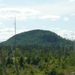
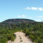
The Head Lake Peaks are a group of peaks north of Head Lake in the hills 65 km West of Thunder Bay. Head Lake Peak East is the highest of the mountain group and shares its ridge with the lower but equally prominent South Peak. It is also only 2.5 km southwest from the highest peak in the region, Tower Mt. Head Lake Peak East is a trailless peak and the closest trail is 500 meters northwest of the summit. The mountain has impressive cliff faces on its southeastern slopes.
Directions:
The easiest approach to the mountain is from the north. From Thunder Bay, take Highway 11 west and pass through Kakabeka Falls. Immediately past the falls, turn left on 590 and head south, then west along the road. 13.4 km from the intersection with Highway 11, Boreal Road branches to the right. Boreal Road, despite being a dirt and gravel road is a well graded and wide road, and seems to see a fair bit of traffic. Stay on Boreal Road for 22.8 km until turning left (southwest) onto Marks Lake Road.
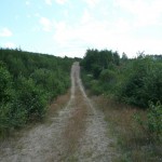
Marks Lake Road is also a well graded road, however 3.4 km from the intersection with Boreal Road, a narrow overgrown 2-track road branches to the left which leads to Head Lake Peak East. There is parking available at the intersection (N48 22.339 W90 06.701), however despite growth in the median between the tracks, the road is in pretty good shape and a passenger car should be able to drive along it for 6.1 km. It would be a good idea to bring a saw and shovel to clear the road and make necessary repairs since the road is not well traveled.
Update: July, 2016 – the road has deteriorated and is now too overgrown for most vehicular travel.
6.1 km from Marks Lake Road, a steep hill will prevent most 2-wheel drive cars from proceeding and a smaller overgrown track on the right (N48 19.864 W90 07.208) marks a good parking spot. From here, it is a 4.8 km hike or bike ride to the end of the road and the beginning of the bushwhack. Stay to the main trail to get to the most optimal location to start the bushwhack (N48 17.944 W90 07.638).
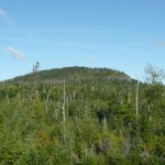
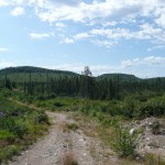
The road terminates at small clearing where the large amount of lumbering debris points to the reason for the road. To the south, thick new growth covers the northern slopes of Head Lake Peak East and South. The remnants of skidder paths travel up the slopes towards the summit, however these paths are extremely overgrown, barely discernible, except for the fact the growth along their edges is higher. In a couple more years, any evidence of the skidder paths will be completely obscured as nature reclaims them.
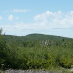
Proceed southeast towards the summit, eventually emerging from the new growth aspen and tag alder into the thinner old growth forest that crowns the summit of Head Lake Peak.
The summit has no easily recognizable high point, but at N48 17.780 W90 07.312 a cluster of trees seems to mark the highest point of the mountain. Proceed east to views of the southern approaches and views of Tower Mt.
00.0 km – Boreal Road Turn off on 590
22.8 km – Left Turn onto Marks Lake Road
26.2 km – Left Turn onto 2-track road
32.2 km – Parking before steep hill on 2-track road
37.0 km – End of the 2-track road, beginning of bushwhack
37.8 km – Summit of Head Lake Peak East
38.0 km – Views of Tower Mt.
View a larger version of the map
Trip Log:
Disheartened from my previous days’ failed effort to summit Head Lake Peak East from the south, I had to convince myself to take another stab at it. After discussing it with Mike, my Thunder Bay guide and host, I decided to try approaching it from the north, along roads that showed prominently on Google Satellite Maps.
Getting a slow start to the day, I left Thunder Bay, passed through Kakabeka Falls and turned left onto 590 just before 11 AM. After a short while I found the turnoff west (right) to Boreal Road. Unlike other gravel roads I had traveled on previously, this road was virtually a highway! I could drive 70 km/h on the wide and well graded road, even with my Grand Am.
While driving up Boreal Road, I was excited to get my first clear view of the Aldina Tower on Carson Creek Peak, a peak I had climbed in the rain just a few days earlier. After about 23 km, I found the turnoff to Marks Lake Road and a short while after that my GPS indicated that I had found the 2-track road which would lead me to the base of Head Lake Peak East.
Initially I decided to park my car at the turnoff to the 2-track road and travel in on bike, because there was quite a bit of growth in between the 2 tracks — this road obviously didn’t see a lot of traffic. But after biking in about 1 km, I decided that the road itself was in good enough shape and I could drive it if I was careful and avoided any undercarriage scrapes. I turned around and got the car and started my way in. At one point a tree had fallen across the road, and luckily I had brought my machete with me, and despite the fact that the machete is a complete piece of crap I was able to make short work of the tree.
I drove along the road until reaching a hill 6.1 km from Marks Lake Road, which my 2-wheel drive car could not ascend. So backing out to an intersection just before the hill, I parked and continued on my mountain bike. Keeping to the main road I passed several side roads, and at one point passed a sign stating that all bridges beyond this point had been removed. No problem now that I was biking it!
Finally about 3.5 km from my car, I reached the last fork in the road. The trail to the left swung around to the steeper eastern slopes of Head Lake Peak East which I wanted to avoid. The trail to the right climbed up the lower slopes of the mountain to the more gradual northwest side of the mountain. I stashed my bike at the intersection and started the short ascent up the right road to the northwest slopes.
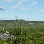
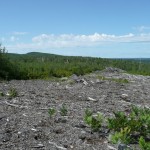
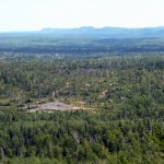
Much of the area had been clear cut logged only a few years ago, opening up great views of the surrounding terrain. The view to Tower Mt. was particularly impressive — the dramatic cliffs of the western face of the 2nd largest mountain in Ontario were clearly visible. Just over a kilometer from my bike, I reached the end of the road which had a large amount of lumber debris (shredded timber and bark, rotting stumps, etc).
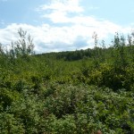
Looking up from the road towards Head Lake Peak East, I noticed what I guessed to be an overgrown skidder trail up the mountain. Barely visible, the only reason I saw the trail was because of the taller growth on either side of it’s edges. If I hiked up this trail I would be able to see my destination over the shrubs and trees that were reclaiming the clear cut. I crashed through the thick tag alder and young aspen trees up the gradual mountain side, but as I climbed higher, the shrubs and trees also grew higher and soon I could no longer see over them. As the slope began to level off, I exited the shrub field and entered the older unlogged forest that covered the top of the mountain.
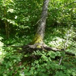
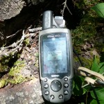
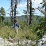
Dodging around fallen trees and thick clumps of trees, I tried in vain to walk straight to the summit coordinates. The top of Head Lake Peak East was difficult to spot. I stopped at a rock that looked to be higher than the surrounding terrain and took photos. But after I explored the summit some more I found an area my GPS indicated was higher; among a group of trees with no views to be had. I waypointed the summit, took photos and proceeded east to look for views south and east to Tower Mt.
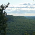
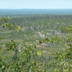
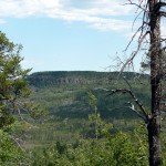
As I neared the cliffs along the southern and eastern sides of the mountain, the forest opened up and I got decent views south to where I had tried to approach the mountain from the previous day. I continued my bushwhack east to find views of Tower Mt.
After taking a quick break for lunch I started back down, trying in vain to follow my route up. I ended up on a parallel skidder trail, which brought me east of the road — I ended up having to bushwhack west to the road. I followed the road back and got my first glimpse of wildlife that day: 3 small grey wolf-like creatures that I took for coyotes darted into the brush ahead of me. Reaching for my bear spray I nervously passed where they had been and continued down the road to my bike. The bike ride back was uneventful but I was disappointed to discover that the route back seemed to be entirely uphill. Despite this, I made good time and reached my car.
On my trip back down the 2-track, I stopped and made a few road repairs with my shovel to avoid any further crunches and undercarriage scrapes.
Head Lake Peak East GPS Track (.gpx format)
Related Links:
Head Lake Peak East
