Tower Mountain
Posted by Derek on Sep 2, 2009
Rank: 2
Height: 2228 feet / 679 m
GPS recorded height: 2260 feet / 689 m
Lat/Lon: N48 18.444 W90 05.667
Line Parent: Ishpatina Ridge (Tower Summit)
Key Col: N49 35.298 W85 41.667 (997ft / 299m)
Clean Prominence: 1247ft / 380m
Date Summited: August 21, 2009
Overview:
Taken from www.peakbagger.com:
Tower Mountain is the second highest peak in Ontario. The peak is part of the range of hills on the northwest shore of Lake Superior, not far from the city of Thunder Bay.
The name “Tower Mountain” is relatively new. For many years this summit was just known as a unnamed spot elevation in the “Thunder Bay Hills”. But the recent Ontario Base Map (1:20,000) published by the MNR (Ministry of Natural Resources) clearly labels the summit with its name and elevation. Ironically, the MNR seems to have forgotten that a tower was ever constructed here.
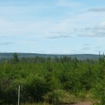
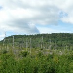
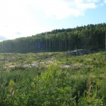
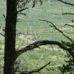
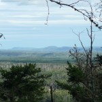
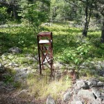
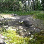
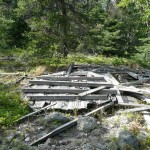
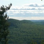
The peak is a broad, flat-topped ridge, with steep slopes and cliffs surrounding the central plateau. The summit is a very broad flat area, and it is marked by clearings with lots of debris from an old tower. You can see the tower footings, the wreckage of the wooden observation box, old cables, and electrical junk lying around. A rise to the north of the tower area may be the actual highpoint, but it’s hard to tell. There are no views, but if you bushwhack to the west for a tenth of a mile you will come to the top of the cliffs, where a nice vista of clear-cut forests extends for miles.
Directions:
There are 2 routes to Tower Mt.:
- A route which approaches from the south starting from Hwy 588 near Suomi. This trip report details this route.
- Alternately, the peak can be reached from the north by following overgrown quad paths which start on Marks Lake/Boreal Road. Click here for a trip report detailing this route.
From Thunder Bay, drive west on Highway 11, and about 4 km before Kakabeka Falls, turn left onto 588 to Stanley. Follow 588 for 52 km through Stanley, Nolalu and Suomi, until passing a camping general store with a Husky gas pump. About 400 meters past this, lies the junction with an unsigned dirt road heading right (north) into the woods.
If coming from the USA, start in Grand Portage, Minnesota. Take Route 61 north for 5 miles to the Canadian border, cross into Canada, and a mile past the border turn left on Route 593, a paved wilderness road that winds for 30 miles (48 km) before ending at Route 588. Turn left, and after 11.7 miles (19 km) you will reach the junction with the dirt road heading north.
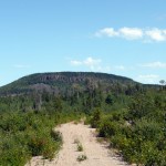
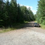
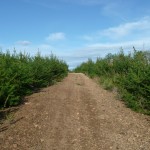
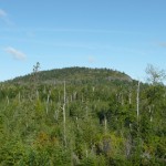
This road is a bit rough, with large potholes and short, steep, bouldery hills in a couple places, but most passenger cars should be able to make it with just a few undercarriage scrapes. This road was not marked on any available maps. Follow it for 12.3 km from Route 588, through massive clear-cuts. The open terrain provides a good view of Tower Mountain while approaching it –it looks impressive, a large prominent ridge with steep cliffs guarding its southwest slopes. The road goes almost to its base and turns right. Depending on the vehicle, one could drive right to the start of the bushwhack near WGS84 N48 18.274 W90 05.107, just before the road starts a steep, rocky descent. There is also a good place to park at WGS84 N48 17.832 W90 05.372, just before the road starts getting a little rough for a 2-wheel drive passenger car, about 1.5 km from the start of the bushwhack.
From here it is an 1.1 km bushwhack north-northwest up the slope to the summit. If you go too far west, you will encounter brushy cliffs, so it is best to stay right when in doubt. After a short, steep stretch you will gain the flatter terrain at the top of the ridge, where you head west-northwest towards the summit. There is no sign of the trail on the topo map (or any trail at all), but the bushwhacking is not too bad since the underbrush is thin on top of the ridge. The highest point is in question as the summit is broad and flat, however a couple of coordinates have been suggested: WGS84 N48 18.444 W90 05.667 (My GPS indicated this was 30 feet higher) and north of this WGS84 N48 18.481 W90 05.666.
Since it is only a short hike to the summit from the car, the peak could be climbed in the same day as other peaks in the area (Carson Creek Peak for example).
Trip Summary:
00.0 km – Turnoff onto unsigned dirt road from 588
10.7 km – Parking on the road 1.4 km from the start of the bushwhack
12.1 km – Start of the bushwhack
13.3 km – Tower debris near the summit
13.4 km – Possible summit south of the tower
13.6 km – Views west to Head Lake Peak East & South
View a larger version of the map
Trip Log:
As weather conditions had greatly improved since the morning, I decided after climbing Prelate Lake Peak to attempt Tower Mt. that same afternoon. I found the turn off just west of a little camp store and gas bar which serviced the many fishing camps in the area. Following the narrow road in, there were many pot holes and puddles from the previous day’s downpour that had to be dodged. After about 10.7 km the road conditions were bad enough that I didn’t want to risk the safety of my car any further, so I decided to park and continue the rest of the way on foot.
I followed the road for another 1.4 km up a hill and rounding the base of Tower Mt to the east. When it looked as if I had reached the height of land on the road, I decided to head off north across the rocky clear cut towards the mountain. Having read the report on peakbagger.com about this mountain, I was conscious about trying to avoid the higher cliffs that crowned the southwestern slopes of the ridge.
Once passing through the clear cut, I entered a thicker forest and the traverse became more difficult especially since the ascent also got steep. Pushing up through the trees and bushes, I came upon about a 8 foot wall of rock, but luckily there was a small gap nearby which I was able to gain foot and hand holds to pull myself up.
As I conquered the cliff wall, I noticed that I had reached the top of the ridge. The terrain leveled out and the forest thinned, making my progress easier and more enjoyable. I walked along the top of the cliffs and enjoyed the partial views south, back where I had come from. Eventually at WGS84 N48 18.367 W90 05.479 I decided to head northwest towards the summit, traversing moss covered rock ledges and fern and juniper matted patches.
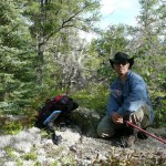
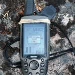
I reached the debris field of the old fire tower that once stood on top and after viewing the lay of the land I figured I had reached the summit. After taking the usual summit photos and GPS waypoints, I decided to continue west to find a view of the Head Lake Peaks. A short distance from the fire tower remnants I caught a glimpse of an area that appeared higher which my GPS confirmed as being 30 feet higher (Disclaimer, GPS elevation measurements are not particularly accurate. The filtered GPS track presented here does not capture all of my meanderings on the summit).
Once completing the summit photos and waypoints for the 2nd time, I continued my track west and was able to find partial views of the ridgeline containing Head Lake Peak East and South, as well as the more distant Head Lake Peak West. Since it was only a few hours until twilight, I headed back to follow my track back down to my car.
Tower Mt. GPS Track (.gpx format)
Related Links:
hi
i was wondering if someone owns this land where tower mountain is located? if you could get back to me that would be great. I am just wondering because it looks like an amazing place to hike.
thank you
katrina simon
Katrina, I believe that Tower Mt is on Crown Land. Refer to: http://www.mnr.gov.on.ca/en/Business/CrownLand/2ColumnSubPage/STEL02_170045.html and the Crown Land Atlas: http://www.lio.ontario.ca/imf-ows/imf.jsp?site=clupa_en.
“Crown land makes up over 95 per cent of the land base of northern Ontario”. I did not encounter any notices restricting hiking in the area when I was there.
Katrina, to follow up with your question, the MNR land use policy (http://crownlanduseatlas.mnr.gov.on.ca/policies.html) reports this area (Area ID: G1908) as a general use area. See http://www.lio.ontario.ca/imf-ows/sites/clupa/xmlReader.jsp?xsl=XML/web-primary.xsl&polid=G1908 and the map: http://www.lio.ontario.ca/imf-ows/imf.jsp?site=clupa_en&extent=-90.9816359,47.9864246,-88.8561098,50.0689774
The road is a lot rougher now, don’t think it’s passable by car any longer. About a mile east of where you parked is our amethyst mine.
hi there long time no see
just read your tower mt adventure
what side is easier boreal road or 588?
seems a longer trip.on bush road
from 588you recommend doing tower mt would u think at least be some type of view point on tower mt is it quite visible
John, I would think the route from 588 is easier and more straight forward, however it depends on the condition of the bush road off of 588. As Raymond mentioned above, the road is a lot rougher now — hopefully if you can drive in far enough to cut down on the amount of kms you have to walk. There will be views along the edge of the cliffs near the summit.
thanks so much. I am thinking of biking in? i am good cyclist? so i might just park on 588 and ride the road in. would i be able to bike up any trail to get to Tower MT? is it quite straight forward to figure out the route off the road? would it be a ok to do this? not crossing on anything private land?
the portion you walked? was it more of tough hike? something you can ride a mt bike on? is climb up tough? thanks
John, It’s all crown land around there, so you won’t have to worry about crossing private land. There’ll be a bunch of forks in the road, so you should make sure to load the GPX track from here onto a GPS or GPS-enabled phone as not to miss the turns.
It’s been 9 years since I did this trek, so I can’t really say how good the road will be. It could be very overgrown, especially as you get closer to Tower Mt.
There are no routes up Tower Mt., you’ll have to leave your bike and bushwhack up the final 1.1 km up to the peak, and this can be pretty tricky, since it’s quite steep up the cliff wall. “I came upon about a 8 foot wall of rock, but luckily there was a small gap nearby which I was able to gain foot and hand holds to pull myself up.”
thanks so much