Silver Peak
Posted by Derek on Jan 23, 2009
Rank: NA (below 2100 feet)
Height: 1768 feet / 539 m
Lat/Lon: N46 06.662 W81 17.357
Date Summited: June 25, 2005
Overview:
Located in Killarney Provincial Park, Silver Peak is the pinnacle of the La Cloche Mountains, a weathered 3.5 billion year old mountain range that was once higher than today’s Rocky Mountains. The peak is so named because of the silvery gleam the white quartzite gives off in the sunshine. Although not the highest elevation in Ontario, the peak is well regarded for it’s mountainous terrain and sweeping views, and as such is a popular hiking destination.
Directions:
There are several routes to Silver Peak, the most common ones being:
- An overland route via the 7-8 day 80 km La Cloche Silhouette Trail, which circumnavigates Killarney Provincial Park
- A 5.7 km hike to the summit combined with a 3.3 km canoe paddle in from Bell Lake (easily accomplished in a day)
- A 3.5 km bushwhack from the Bell Lake Parking area to the Silver Peak Trail and completing the remaining 5.7 km to the summit on this trail
Below details the route to Silver Peak via Bell Lake:
From Toronto, take Highway 400/69 north past Barrie and Parry Sound. 29 km past the French River turn left (West) on 637. At kilometer 36 on 637, there will be a gravel road turn off at the right (North) to the Bell Lake Access point. Depending on the time of year, parking permits may not be available at Bell Lake and will need to be bought at the George Lake Park Office, which is 20 km further along on 637. There may be a sign at the turn off indicating the status of the Bell Lake permit office. Camping/backcountry passes are not needed if this is a day trip outing. It’s a 9 km drive from 637 to the parking area at Bell Lake. Canoe rentals can be arranged at Bell Lake.
With a canoe, it is a easy 3.3 km paddle north around the head of land and then west to the narrows. The landing for the portage at the end of the lake is a muddy bog. Be careful bringing the canoe ashore here. Optionally, bring a chain and lock to secure the canoe to a tree, as it’ll be left here for the remainder of the day.
From the portage, it is a 2.3 km hike to the intersection with the La Cloche Silhouette Trail. Proceed west (right) on this generally well established trail for 1.6 km until it intersects with the Silver Peak side trail which will be on the left. Proceed south along this trail which will climb at a moderate, but steady pace for 1.9 km to the summit.
Silver Peak is a ridge with several high points. The highest is nearest the trail and is marked by the footings of a fire tower which once stood on this spot.
View a larger version of the map
Trip Report:
Silver Peak was my introduction to hiking the backcountry ‘peaks’ of Ontario. Although, not one of the higher mountains in Ontario (well below the 2100 foot requirement for my high peaks list), Silver Peak is probably more mountainous than any other in Ontario. With it’s rocky, bald summit, alpine vegetation and beautiful views, it certainly gave that impression.
I managed to convince, Heather, Tony and Val to join me for the adventure. We had gone up to Sudbury to visit family, and Silver Peak was close enough to do as a day trip.
From Sudbury, it was only 1 hour 20 mins to the parking area at Bell Lake. However as the park office kiosk was not open, we discovered that we had to go to the main office on George Lake to get a parking pass which delayed our departure by an hour. Once back at Bell Lake, we arranged our canoe rental and then launched just after 10:00 AM.
Bell Lake was calm and the canoe paddled fairly easily. Once we made the turn west and paddled into the narrows, we spotted Silver Peak and it’s silver-white granite cliffs. 3.3 km from Bell Lake launch point, we were already at the end of the narrows, and I spotted the portage unfortunately a muddy quagmire. As the only one with sandals, I was voted the one to jump out and ease the canoe up on shore. This turned out to a bit of an adventure. Once I stepped into the water, the muddy quagmire struck and I sank up to my waist in the (smelly) mud and was stuck for a few seconds. The canoe kept coming in to shore, threatening to run me down while my hiking companions tried to stop the canoe in between their laughter.
After securing the canoe on shore and cleaning off my legs and feet so I could put on my boots, we set out and began the hiking portion of the trip. It was at this point that I decided that hiking in June might’ve been a big mistake. It was hot, humid and we were traveling through some wetlands; this seemed to attract hordes of mosquitoes. Luckily the wide, level trail was nothing like the rugged trails of Killarney lore, allowing us to make a quick escape from the bugs. We joined the La Cloche Silhouette Trail at 2.3 km and then spotted the cut off to Silver Peak at 3.9 km. It wasn’t until we were halfway up the mountain that the bug attack abated enough for us to permit stopping for a food and water break.
The Silver Peak trail was a moderate but steady 1.9 km climb to the top. The summit, which is marked by the remains of a fire tower, afforded some beautiful vistas and we enjoyed them in a bug free alpine environment. The Silver Peak ridge extends from east to west. To the south, we were awed by the beautiful blue lakes nestled among the rolling ridges of Killarney. To the north we even spotted the ‘Super-Stack’ of Sudbury. Although a little early in the season, Val managed to find some blueberries to eat.
Silver Peak GPS Track (.gpx format)
Related Links
Silver Peak on Summit Post
Unlostify (Jeff’s) Killarney Map
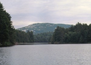
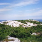
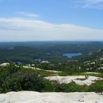
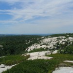
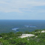
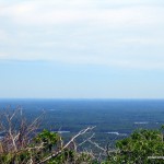

Awesome pictures!!! I can’t make out the super-stack however in the view north pictures.
Hi Andre, these photos are from my pre-digital camera era, so the quality/scan of them isn’t the best. I uploaded a photo for you of the ‘Super Stack’ which you can just make out in the distant haze.
I hiked Silver Peak this weekend. It’s well worth the trip. The best view in Ontario as far as I’m concerned. Like the article says, it’s a well-kept secret. Everyone has heard of Algonquin but few seem to know about Killarney.
There is really no need to rent canoes to get to the start of the trail on Bell lake.
The 3 1/2 k. to bell lake can be hiked using an old logging
road that can be accessed on the west side of the office.
It is not maintained but easy enough to follow
Killarney outfitters will not admit that it exists
They want to rent their canoes at a high price for a short paddle
I have been going to the park for over 40 yrs.
Vaughn, thanks for the heads up.
I recently discovered Unlostify (Jeff’s) Killarney Map and noticed this trail marked on his map. Good to know from your firsthand experience that the trail is indeed still there and is easy enough to follow. I would’ve been tempted to use it if I had known about it, however the canoe paddle was a nice respite from the annoying bugs we experienced that day.
[…] of our best trips was a hike up to Silver Peak. We booked through KML, and had two awesome tour guides. We took 3 Kayaks through Bell lake, landed […]
I’ve been wanting to go to Silver Peak for over 50 years now. I may make it or may not but I sure appreciate your post/photos
[…] high points of the La Cloche mountains. This mountain range in Killarney Provincial Park is over 3.5 billion years old and once stood higher than the Rocky Mountains of the west . Although weather and time have brought this mountain down several notches it is still a steep and […]