Ishpatina Ridge (North Peak)
Posted by Derek on May 25, 2010
Rank: 3
Height: 2221 feet / 677 m
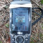
GPS recorded height: 2247 feet / 685 m
Lat/Lon: N47 19.977, W80 44.014
Line Parent: Ishpatina Ridge (Tower Summit)
Key Col: N47 19.742 W80 44.593 (1640 ft / 500 m)
Clean Prominence: 581ft / 177m
Date Summited: May 1st, 2010
Overview:
The Ishpatina Ridge traverses several rounded humps and under the Ontario 2100 Footer criteria, 3 of these qualify as being distinct 2100+ foot peaks. The familiar Fire Tower summit of the Ishpatina Ridge is the highest point in Ontario and a popular destination. It is reachable via a trail from Scarecrow Lake. The North Peak as seen from the Fire Tower summit appears to be just as high if not higher, but according to Ontario’s Ministry of Natural Resources Ontario Base Maps (OBM) series, it is 43 feet lower. There is no trail to the North Peak of the Ishpatina Ridge and several approaches are hindered by cliffs surrounding the peak.
Directions:
Having visited the area in 2007, I discovered first hand that the main Ishpatina Summit (Fire Tower peak) and the North Peak are separated by a deep valley and steep rock faces, which would make a bushwhack between the two peaks hazardous.
I had initially outlined a route which starts from the shore of an unnamed lake west of the north peak. The small stream that drains from this unnamed lake into the south end of Smoothwater Lake near the portage to Apex Lake is not a viable route. Jack Bennett (author of Not Won In A Day) who climbed the North Peak from the unnamed lake describes the creek as “canoe frogging” at its maximum.
Instead, begin the trip on foot at the southern shore of Smoothwater Lake. Follow the standard approach from the Montreal River Access Point to Smoothwater Lake, proceed to the south end of Smoothwater lake and follow the 780 meter portage to Apex Lake. Once reaching Apex Lake, the 5.1 km bushwhack (3.8 km as the crow flies) begins; first rounding the northern shore of the Lake and then proceeding in a 220 degree true (compass course of 231 degrees) direction through the mixed forest along the Ishpatina Ridge. The bushwhack climbs steadily from 1350 feet at the shore of Apex Lake, and reaches the first bump along the Ishpatina Ridge at 2000 feet. The route then descends to 1750 feet before climbing again. 3.8 km from Apex Lake the bushwhack ends at 2220 feet on the 3rd highest peak on Ontario. There are good views along the crest of the southern cliffs of the North Peak of the higher Fire Tower Summit on the Ishpatina Ridge.
Note: Bushwhacking long distances through forest in this area can be very demanding. It is recommended to give yourself on average 1 hour to cover 1 km of bushwhack.
View a larger version of the map
Trip Log:
Having seen the rugged rock cliffs of the North Peak from the top of the Ishpatina Ridge (Fire Tower Summit) back in 2007, I knew that one day I would return to the area to climb it. The steep canyon between the two peaks is one of the deepest in Ontario, and the rock cliffs on both sides of the canyon make a traverse between the two peaks a daunting trek.
When I heard reports of an early spring and how the lake ice had retreated early, I jumped at the opportunity to beat bug season in Temagami and try my luck with a bushwhack to this remote peak. I convinced my father, Jim to join me on the trek and we decided to approach the mountain from the south end of of Smoothwater Lake.
We left Southern Ontario early Friday morning on our three day adventure into the heart of the Lady Evelyn-Smoothwater wilderness. The plan was to drive up Highway 11 to New Liskeard, and then take Highway 65 to Elk Lake and beyond Elk Lake take Highway 560 to the eventual turnoff to Beauty Lake Road. We would then drive to the Montreal River Access point, put in my square stern canoe outfitted with my little 4HP outboard motor, and make our way up the Montreal River to Smoothwater Lake. We’d make camp at the south end, ensuring we had the entire next day to make the trek up to the North Ishpatina Peak from camp and return back to camp.
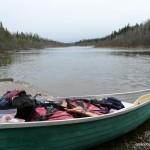
Everything was going according to plan. We made our way northward without incident, got our backcountry passes at “Dad’s” in Temagami and eventually reached the deserted parking area at the Montreal River at 3:30 PM. Not a soul in sight. After unloading the canoe and stowing our equipment on board we departed the landing — just after 4 PM.Having called Finlayson Point Provincial Park before we left, I confirmed that motorized craft were allowed in Smoothwater Lake. And I remembered seeing fishing boats in Lady Dufferin Lake from my canoe trip to Ishpatina back in September 2007. That’s why I was surprised to see some of the obstacles that were to be faced using such a vehicle. Less than 2 km into the trip, we faced a small set of rapids with large rocks looming just under the surface. I had to pull the motor up and we had to paddle hard to get ourselves up and over. At several other instances along the river, I had to pull my little motor up to avoid shallow sections of the river.
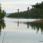
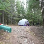
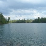
My outboard motor education began at the mouth of Smoothwater Lake. As we proceeded onto the lake, the lake got shallow quickly and unfortunately I wasn’t fast enough to pull the motor out. The motor fin hit bottom and the motor began to rev really fast. Ok, I thought, it’s just a sand bar, how could there be any real damage, maybe the motor just needs to be stopped and restarted. Again the sound of wailing motor. We pulled up on shore and examined the motor. I had some basic tools (read: a multi-tool) and we examined the motor. After pulling apart the propeller assembly we found the problem: a broken shear pin. And that’s when I discovered that a shear pin is not the same as a cotter pin. I had extra cotter pins, but up to that point I had thought the two names interchangeable. Luckily my father mentioned that people have often used nails as a quick temporary fix for a ‘sheared’ shear pin. We modified one of my cotter pins as a replacement, re-assembled the motor and after a few pulls of the starter rope, made our way across a calm Smoothwater Lake. We carefully made our way to the south end of the Lake and pulled up onto the swampy shoreline at the portage to Apex Lake, just before 6:30 PM. We made camp beside the portage, and were glad we were here the first weekend of May. Since much of the nearby area was either swamp or slow moving river, it would be a mosquito/black fly hell in a week or two.
Geared up for our day hike south to the North Ishpatina Ridge Peak, we broke camp the following morning just after 7:30 AM. We made the “easy” (I don’t remember it being so easy with a canoe on my shoulders back in 2007) trek to Apex Lake, and decided to filter water for the day’s hike there instead of pulling swamp water from Smoothwater. In order to round the northern shore of Apex Lake, we backtracked 100 feet up the trail to thinner bush and started what we hoped would be a 3.7 km bushwhack.
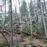
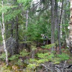
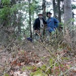
Initially the going was tough. We descended into thick bush, swamp and dense coniferous forest. At some point there must have been a logging camp at Apex Lake, as I found a few artifacts, including a chamber pot at the top of a steep hill. What appeared to be an old road paralleled a small creek running northwest from the swamp around the northwest edge of the lake. However, as we began to make the steady ascent along the Ishpatina Ridge, the forest turned into a mix deciduous/coniferous forest which allowed easier passage. We proceeded on a 220 degree true (compass course of 231 degrees) course and would have to pass over the first bump along the ridge to gain access to the North Peak. At 1.6 km from Apex Lake, we encountered some interesting rock formations that seemed out of place for the area. We made slow but steady progress but I had factored an hour for every km as the crow flies and we were keeping to that schedule. After cresting the first hump along the Ridge, we saw the North Peak for the first time on the other side of the divide between the two humps. We managed to avoid a cliff wall to our left as we made the steep descent down the to the col. A small creek flowed down at the bottom, and I made a mental note that we would resupply our water bottles on our way back. The climb up the North Peak was steep, but we did not encounter any difficult rock faces. As we ascended, the pitch lessened and the woods were quite passable. The summit area was littered with moose scat. All along the hike up the Ridge I had seen traces of moose and broken, but otherwise healthy coniferous tree limbs laying about. I guess we had the moose to thank for thinning out some of the underbrush, creating the ‘moose pasture’.As we made our final ascent, the winds picked up and I knew that we were approaching the top of the Peak. The actual summit was difficult to pinpoint, and after completing several rounds of the area, I decided that a small grouping of trees looked to be the highest point, at N47 19.977 W80 44.014. It was just after 12 PM, it had taken us 4 hours to bushwhack 5 km (3.8 km as the crow flies) from Apex Lake to the North Ishpatina Ridge. We took our summit photos, I waypointed the summit and afterward we made our way south along partial clearings that showed off good views of the area.
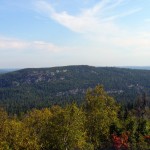
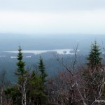
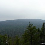
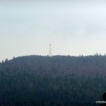
It had rained on and off during the day, but even with the haze, we found some great views of Mihell Lake. After pushing further west, we came upon a small rock slide which opened up to reveal the Ishpatina Ridge Fire Tower Peak and the steep canyon that separates the two peaks. Even the fire tower was visible through the haze.
After enjoying the views, we turned around and started our trip back to our campsite on Smoothwater Lake. Attempting to trace our route in, I conferred with my GPS and adjusted our hike out, criss-crossing over the original track. We found the small creek at the bottom of the col between the two humps and filtered some water, then headed over the north hump. We had left the summit at 12:50 PM and reached Apex Lake at 4:45, almost 4 hours later. We headed into camp a short time later.
The next morning, we broke down our camp and made our way out across a calm Smoothwater Lake. As outboard shear pins are designed to break under stress, and a modified cotter pin serving as a replacement shear pin is not, we made careful voyage down the Montreal River. At several instances I had to pull up the motor to avoid damage, however despite the inconvenience, the outboard saved us much time, as we were able to complete the trip in under two hours instead of a 4-5 hour paddle.
Note about bushwhacking: Don’t wear good clothing as it can easily be shredded!
Trip Summary:
00.0 km – Turnoff on 560 onto Beauty Lake Road
23.0 km – Boat launch at Beauty Lake Road onto the Montreal River
41.9 km – Portage to Apex Lake
42.7 km – Apex Lake and start of bushwhack to Ishpatina Ridge – North Peak
47.5 km – Summit of Ishpatina Ridge – North Peak
47.8 km – Views of Ishpatina Ridge – Fire Tower Summit
Ishpatina North Peak GPS Track (.gpx format)
Related Links:
Deseronto’s Ishpatina trip report
Ishpatina Ridge (Tower Summit)
Ishpatina Ridge North Peak on Peakbagger.com
